Fonte Dam, River, & Overlook hike on Nimitz Hill, Guam is a fun and historical hiking experience here in Guam. I really thought we were just going to see and dam and it was so much more! This has been one of my favorite hikes here.
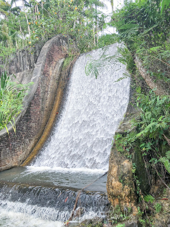
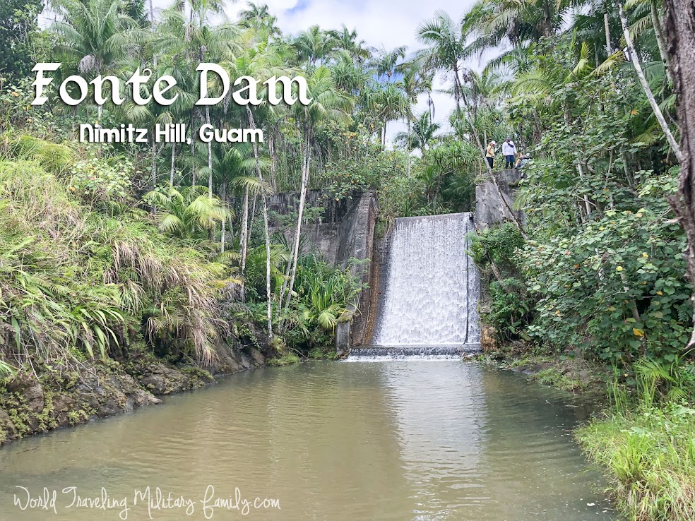
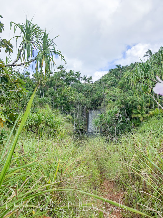
One of the reasons I was excited to do this hike is because of the history, I mean who doesn’t want to seen an amazing dam structure that was built back in 1910?! It was constructed by President Taft to supply water to Hagatna. It’s 150 feet wide and 24 feet tall, I was impressed! Both by the view from the walkway at the top and from the view at the bottom of the dam. If your interested in more history of the dam you can find some HERE.
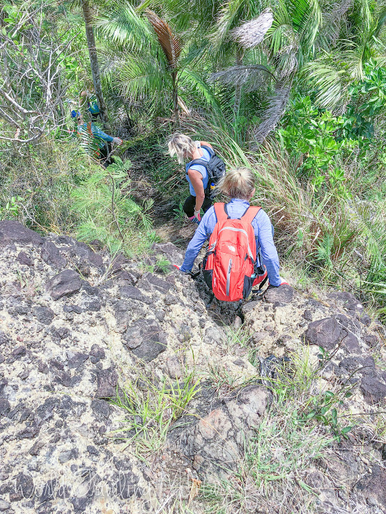
The hike starts on the grassy trail by the power substation. From there you hike down a bit and take a left by the Fonte dam sign. I highly recommend using the Best Treks on Guam book if you have it! Or going with someone who has done it and knows the way. If not there are several websites that can give you more detailed instructions.
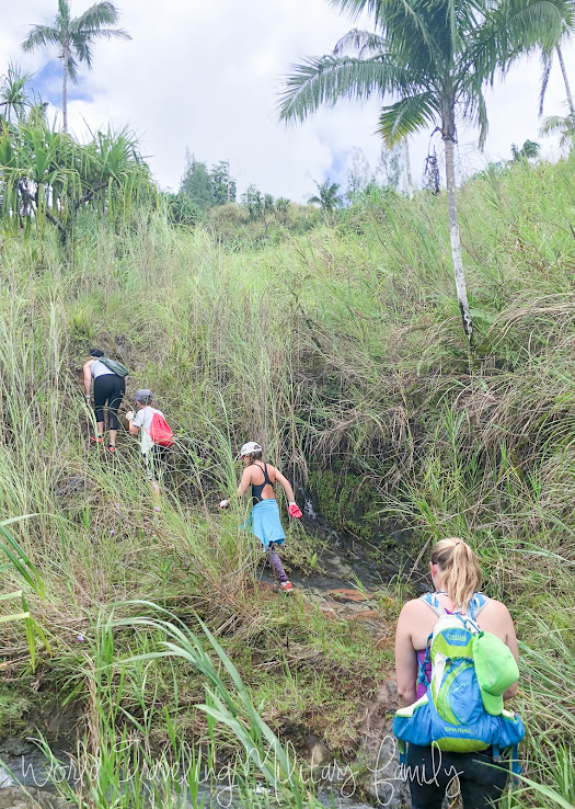
Also know if it has rained the trail may be a bit slippery and muddy! It was a little muddy for us but nothing terrible. We did notice mosquitoes when we got to the top of the dam area so bug spray is a must for this one. There is also sword grass so pants/long socks are helpful.
We stopped at the top of the dam and walked out on the narrow walkway to get some awesome pics and views. If your not fond of heights this is not the best idea as the path is narrow and it’s about a 24 foot drop. It does make for some great photo opps, especially if you have someone take a photo from the bottom of everyone on the top.
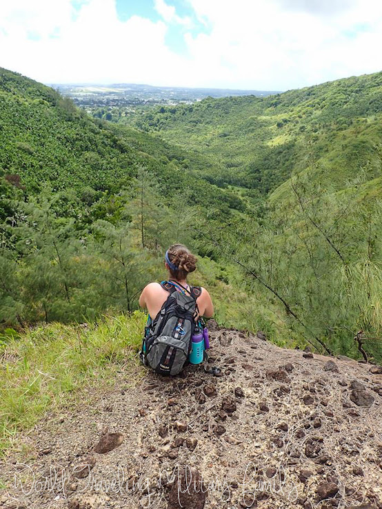
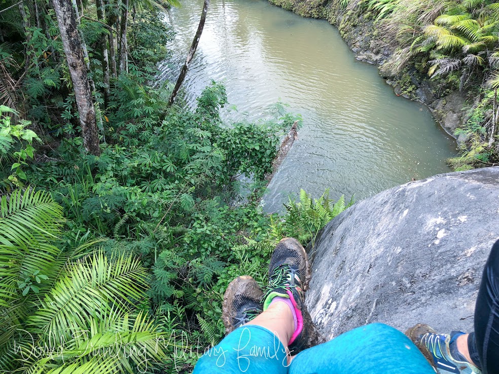
If you cross over to the right you can hike up to the overlook area which has some great views. Also you can hike further to the South to the memorial site of the Korean Air crash from 1997. We didn’t make it to the memorial site.
After a bit of a downhill trek you arrive back at the river and follow it around to the swimming/jumping area.
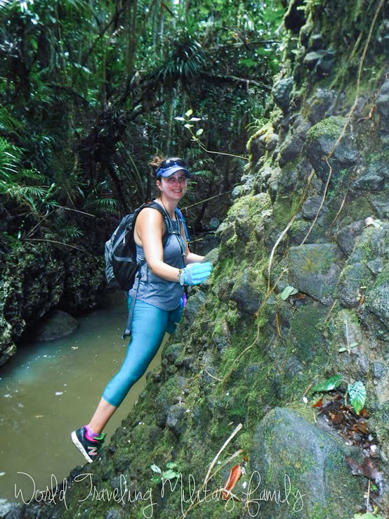
There is an area where you can climb around the rock wall to stay out of the water. Although you can walk through the water instead, it was about thigh deep.
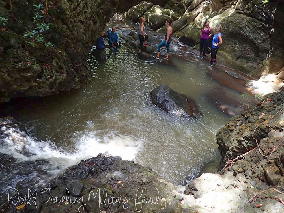
At the swim area there is a jumping spot to the right of the falls but you need to have someone check the water depth and where the rocks are before jumping! There is also a small cave area to the left that you can go in and sit on a shelf if so desired.
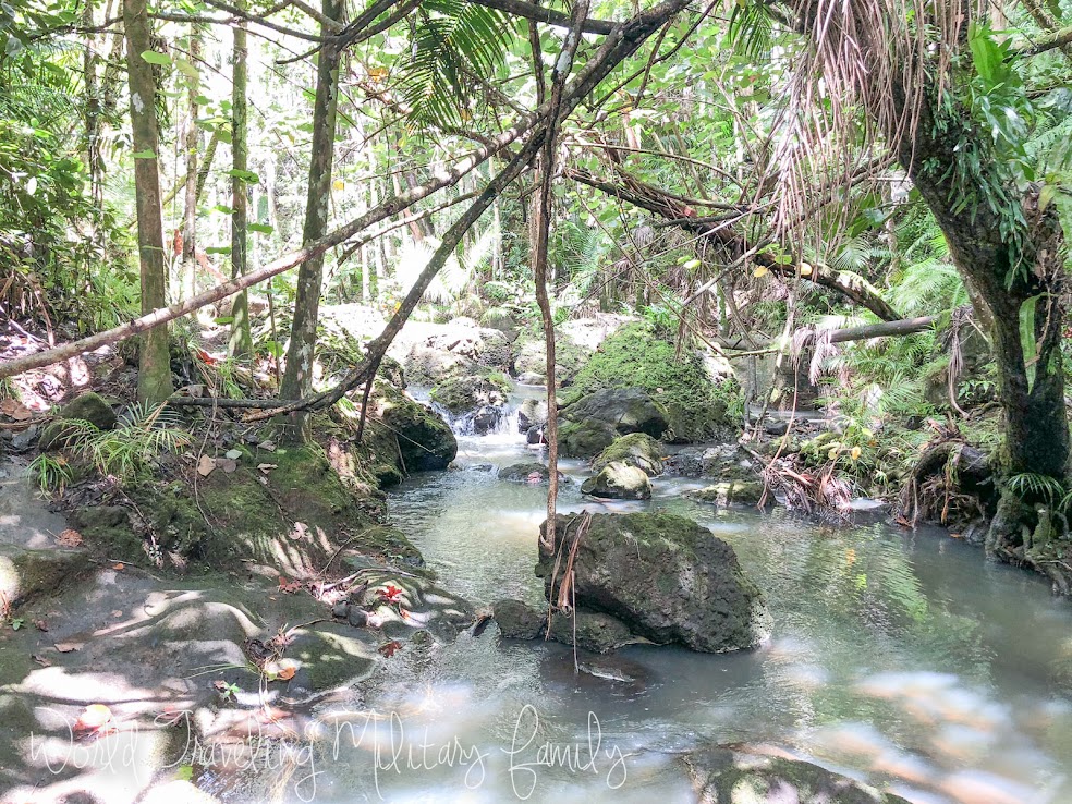
The hike back up was fairly straight forward along the river. We did get a bit off the beaten path for a few mins but made it back to the top with no major issues. A little bit of river walking too but it’s shallow.
Have you done Fonte dam, river, & overlook hike? What did you think?!
Know Before You Go
What: Fonte dam, river, & overlook – Nimitz Hill, Guam
Hike Info: Rated – Medium, Length – 0.8 miles, Elevation change – 400 feet down & up.
How To Get There: Put in Joint Region Marianas Headquarters in Waze or Google maps it’s located on Nimitz Hill. The parking area/start area is just across the street near the power substation. You’ll see a brown historical sign.
Bring: Water, gloves, pants or long socks for sword grass, bug spray, sunscreen & snacks (if desired). Visor/hat/sunglasses are optional. Also waterproof bags for cellphones, at a bare minimum as zip lock bag so it doesn’t drown if you get caught in a downpour! Camera floats are also helpful for waterproof cameras & waterproof cell phone bags.
Parking: There is a grassy area were people park by the power substation. If it’s full there are some parking lots for the Joint Region Marianas Headquarters across the street.
Cost: Free
Traveling with little kids: While this hike is under a mile long there is some uneven ground and it’s a bit tricky if wet & muddy. We did to this with kids ages 7-12 and they did well. There was also a set of grandparents with us who rocked it also they did have to go a bit slower on some parts of the path that were slippery.
How long: Plan on at least 1-2 hours, more if you want to hang out at the swimming area longer.
Leave a Reply